The core objective of this research is to develop an ecological checklist for assessing agricultural landscapes in Taiwan's low elevation mountains. This ecological checklist will be developed grounded on a wide-range and multi-aspect scientific research basis. More specifically, the interactive relationship between agricultural production and environmental factors will be studied, as well as multi-scale remote sensing data will be utilized to monitor the agricultural landscape environment. Members involved in this research include the application of remote sensing, the exploration of the interaction of environmental factors, long-term ecological research, long-term surface vegetation changes, environmental resource conservation, and forest soil and water conservation. The preliminary results from the past two years are summarized as follows:
1. Agricultural landscapes monitoring:
Consider the concept of eco-agriculture, in conjunction with multi-period satellite image data and image processing technology, quantitative analyses were implemented to explore the changes in the spatial structure of agricultural land in the low elevation mountains area.
2. Explore the low elevation mountain agricultural landscapes ecosystem:
Using remote sensing data and resources from relevant ministries such as the Water Conservation Bureau, Forestry Bureau, and Water Conservancy Department, a multi-period analysis of the spatial structure of agricultural landscapes ecosystems in the low elevation mountain area is conducted to facilitate the establishment of quantitative tracking indicators suitable for Taiwan.
3. Establish the blue belt (water system) structure in the low elevation mountain area:
At present, six important rivers, including Beigang Creek, Wuxi, Dajia Creek, Zengwen Creek, Puzi Creek, and Gaoping Creek, have been selected to establish the proper water system structure analysis. The quadrant distribution of the stream power curve represents the successional development of the transition region from the mountain to the plain. In the future, 24 centrally managed rivers in Taiwan will be further analyzed to define the water system range and river characteristics of Taiwan's low elevation mountain area.
4. Explore the relationship between waterfront plants and water environment evolution in extreme climate:
To explore the impact of waterfront plants on river beds under sandy conditions and the evolution of bed types under the increasing frequency of extreme climatic events for river management.
5. Establish a green belt (agricultural road, rural road, windbreak forest belt) structure in the shallow mountain area:
6.Unique Technologies: Intelligent Monitoring of Agricultural Landscape Ecology and Rehabilitation
(1)Studying the Relationships between Agricultural Production, Humanistic Care, and Environmental Factors
Prof. Ming-Der Yang’s team developed the “Best AI Configuration of Mask Transportation” and won the second place in the AI Creative Competition. By utilizing Big data and AI evaluation, it can obtain the optimal model of mask transportation. In the future, this system can also be applied to precisely deploy critical resources in Taiwan through collection of multiple real-time data from the government open data. Furthermore, this technology also can be applied to the transportation of critical goods, such as vaccines or other urgent required goods during disasters.

(2)Intelligent Inspection Technology for Agricultural Disaster
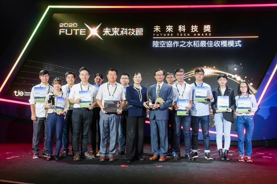
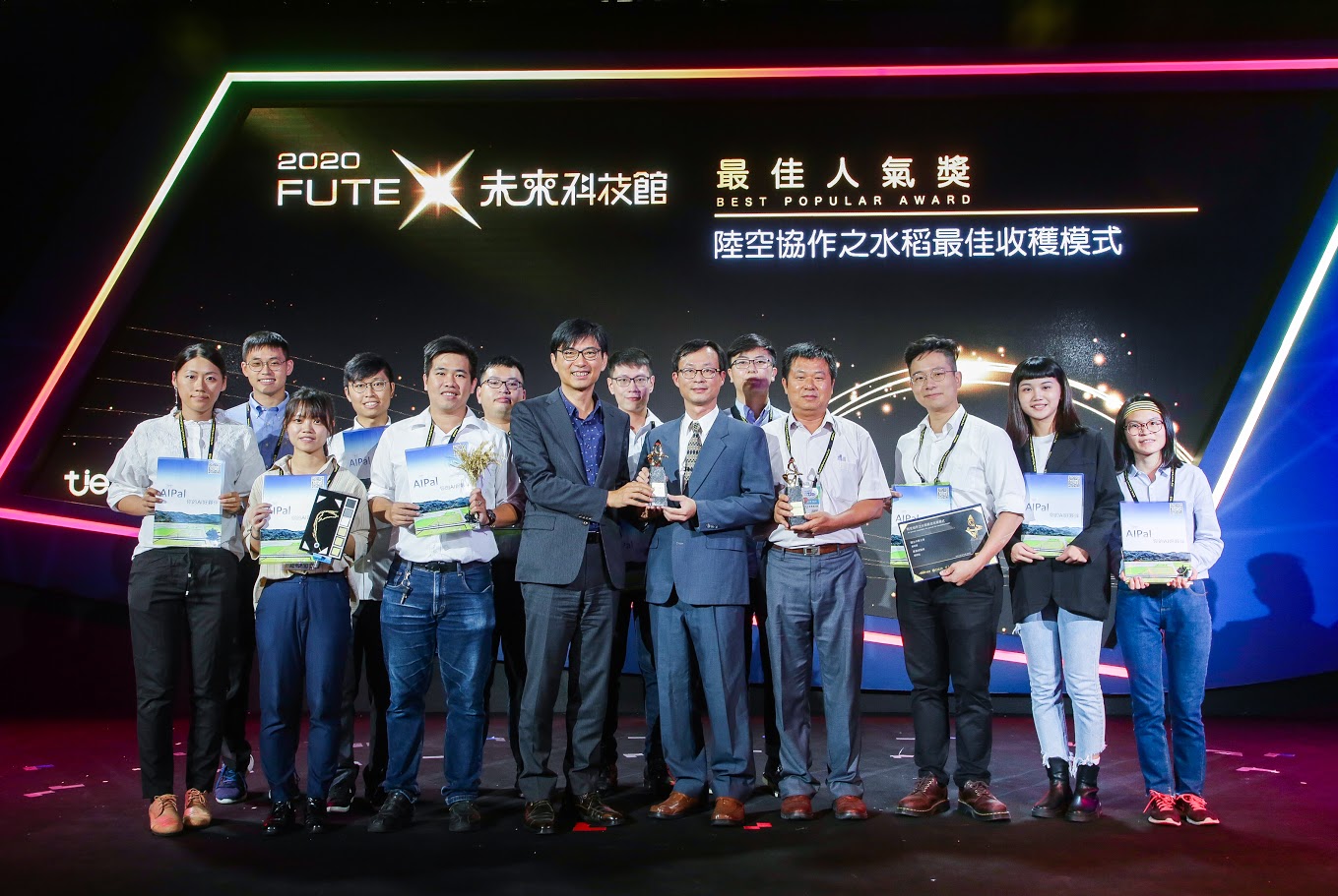
Prof. Ming-Der Yang’s team developed AI technology to recognize images of rice fields from smartphones and UAVs for the distribution of rice moisture content. The rice field information was collected with high efficiency, low cost, and large scale area to increase quantity and quality of crop. This technology implemented in open fields in Wufeng district, Taichung, and received the 2020 Future Technology and Best Popularity Award.
(3)Incubation of Talent
Professor Ming-Der Yang (Department of Civil Engineering) won the “Runner-up” at the 2020 CTCI(中技社) Foundation AI Innovation Competition Award for inventing "AI Model of Mask Deployment Optimization" .
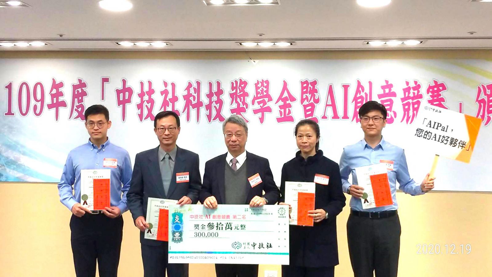
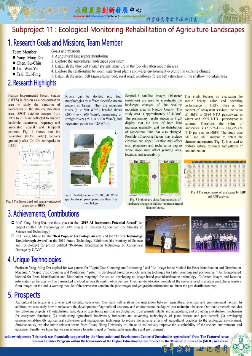
Figure. Research Acheivements(Subproject 11)
Figure.Prof. Ming-Der Yang developed “Air/ground cooperation for optimal rice harvesting” that won the 2020 Future Science and Technology Breakthrough Award and the 2020 Best Popular Award.